North Okinawa · IheyaNo.664★Open in map →
Iheya Island
— Okinawa's northernmost inhabited island
Okinawa's northernmost inhabited island has no bridge and no airport, only a ferry the village runs itself. What waits at the far end is a pine that grows sideways under national protection, and a cave holding the southernmost telling of an old myth.
- FromUnten Port, Nakijin
- ~80 minVillage ferry, twice a day
- Get off atMaedomari Port (Ferry Iheya III, Unten route)
- From there
- Iheya Island
The sweet spot
Iheya is quiet because it is awkward, not because it is secret. The ferry runs twice a day from a port well up the main island's northern coast, there is no bridge and no airport, and attempting it as a day trip means spending most of the day on the water. That filter is the whole reason the island still feels like itself.
Where it is
43 more notes in Okinawa · open the map →What to look for — in walking order
- Maedomari Portthe island's only ferry pier and the practical centre of village life
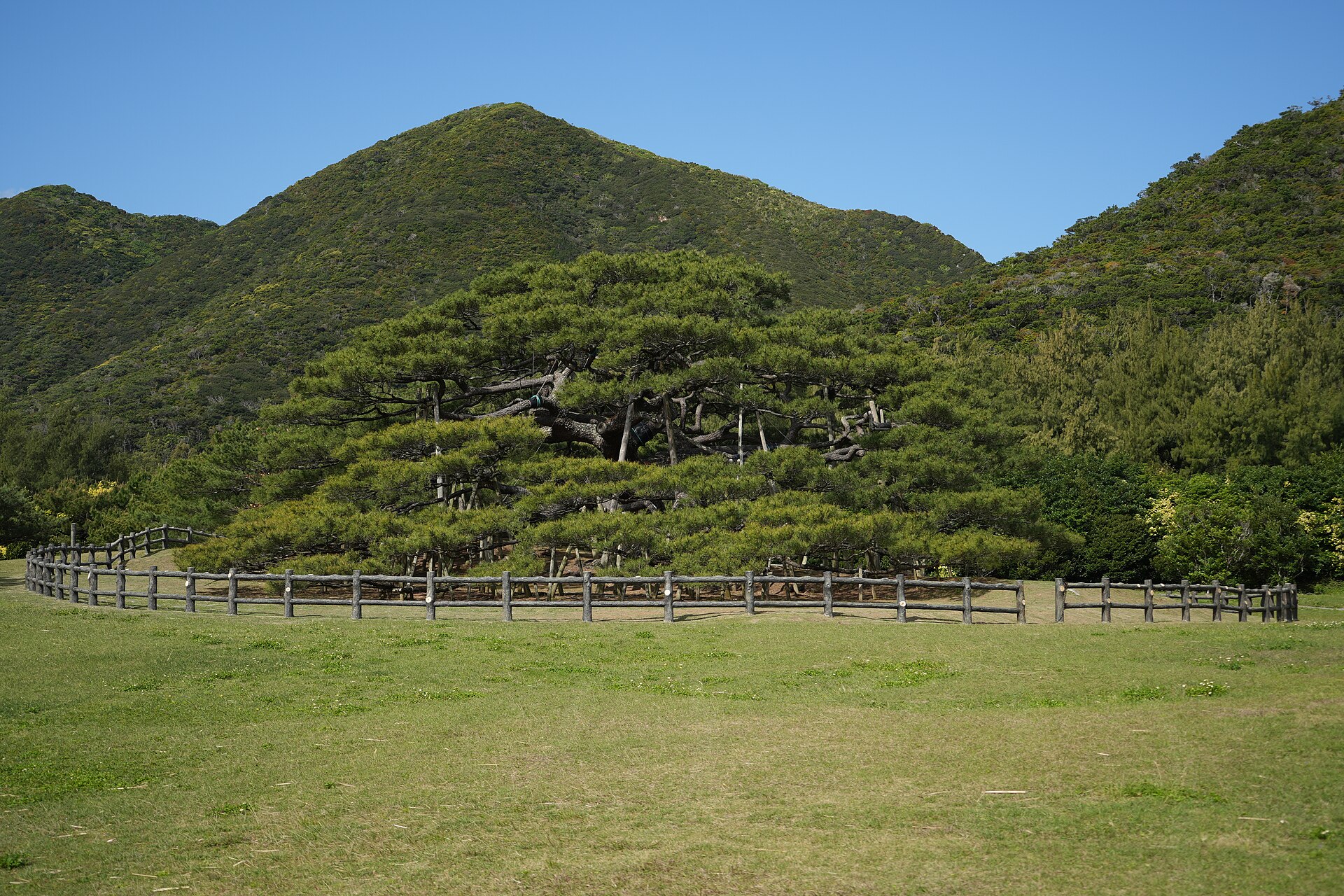
- Nento Hiramatsua protected pine at Dana, branches running out flat rather than up
- Kumaya Cavea prefecturally protected cave on the north coast, tied to the rock-cave myth
- Mount Kuba and Iheya Lighthouseprotected forest at the island's northern tip, with the light standing above it
How to actually get there
- Naha → Unten Port, Nakijin (Yanbaru Express bus direct, or the highway bus to Nago and a taxi).
- Unten Port → Maedomari Port, Iheya (Ferry Iheya III, about 80 minutes, twice a day).
- Maedomari → Dana for Nento Hiramatsu (rental car, scooter or bicycle arranged at the port).
- North again to Kumaya Cave, then up to Mount Kuba and the lighthouse at the island's tip.
- Ferry from Unten Port in Nakijin
- Unten Port, Nakijin →(Ferry Iheya III, about 80 minutes)→ Maedomari Port. The village runs the boat itself, with two sailings a day in each direction. Reaching Unten from Naha means either the Yanbaru Express bus, which runs direct, or the highway bus up to Nago and a taxi from there.
- Return from Maedomari Port
- The same ferry sails back to Unten twice a day, and even the later departure is an afternoon one, with nothing in the evening. Cars are carried but need a vehicle ticket bought before boarding. Foot passengers can usually walk on, though the crossing can also be booked online in advance.
About the place
Iheya lies about forty-one kilometres north of the Motobu peninsula, the last inhabited island before Kagoshima's waters begin. A ridge of hills runs most of its length, and the settlements sit on the flat ground between the hills and the sea. The island's best-known thing is a single tree. Nento Hiramatsu, the pine at Dana, stopped growing upward and pushed its branches out level instead, low enough to stand under, and it is protected as a national natural monument. Farming and fishing still carry the island. Even the ferry that serves it is run by the village rather than by a shipping company.
How to enjoy it
As the timetable stands, the boat lands after midday and the last one back leaves not long afterwards, so a same-day return gives you well under an hour ashore. Iheya is an overnight island whether you planned it that way or not. Arrange a car, a scooter or a bicycle before you sail, because nothing meets the boat, and keep the northern tip for late in the day when the light comes in across the water from the west.
Background & history
The pine at Dana is old enough that its age is argued over rather than recorded, and the designation as a national natural monument rests on its shape rather than on its years: branches leaving the trunk barely above head height and running out flat in every direction. The cave at Kumaya is the island's other protected site, listed by the prefecture. The story attached to it is the one about a sun deity shutting herself inside a rock cave, told in many places across Japan, and told here further south than anywhere else.
Before you go
- Cash
- The pine, the cave and the coast cost nothing to visit. The ferry fare is paid at the terminal, with an environmental levy collected on top of it. There is very little card payment on the island and no easy cash machine, so bring across what you expect to need.
- Good to know
- Typhoons close the route outright in late summer and autumn, and the village warns that bad weather and drifting pumice can cancel sailings or shift the times at short notice. There is no alternative crossing when that happens. Winter here is windy rather than cold.
- Another way
- Noho, the small island off the south-western corner, is joined to Iheya by a bridge and can be driven straight onto. It is the half-day to fall back on when the exposed northern coast is unpleasant in the wind.
- After you get off
- Maedomari is the only pier and the arrival point itself. Nothing meets the boat, so arrange a rental car, scooter or bicycle through the tourism association before you sail. The pine stands north-west of the port along the coast road, and the cave and the lighthouse lie beyond it toward the island's tip.
Nearby notes
Distances are straight lines on the map, not travel times.