East Nagano · TomiNo.787★Open in map →
Unno-juku
— A preserved Edo post town in Tomi
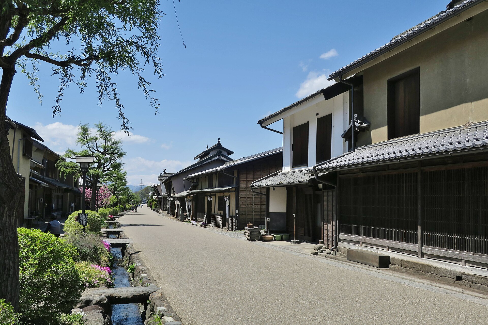
A preserved street of the old Hokkoku Road in eastern Nagano, where about a hundred houses stand along a central water channel. The row served travellers first and silkworms afterwards, and both trades left marks on the same facades.
- FromUeda Station
- ~20 minShinano Railway, then a walk
- Get off atTanaka Station (Shinano Railway Line)
- From there
- Unno-juku
The sweet spot
This is a quiet street, and honestly it is quiet because the traffic left. The railway pulled the road's business away in the Meiji years and the town has never had it back. What that leaves is a preservation district you can walk in twenty minutes without a queue, and a puzzle worth setting yourself: pick out which fire wall, lattice and roof vent belongs to which century before you reach the far end.
Where it is
27 more notes in Nagano · open the map →What to look for — in walking order
- Shiratori Shrinetutelary shrine at the eastern end, its precinct held around a single very old keyaki tree
- The channel down the streetrunning water set along the middle of the road with small stone bridges crossing it, kept from the highway era
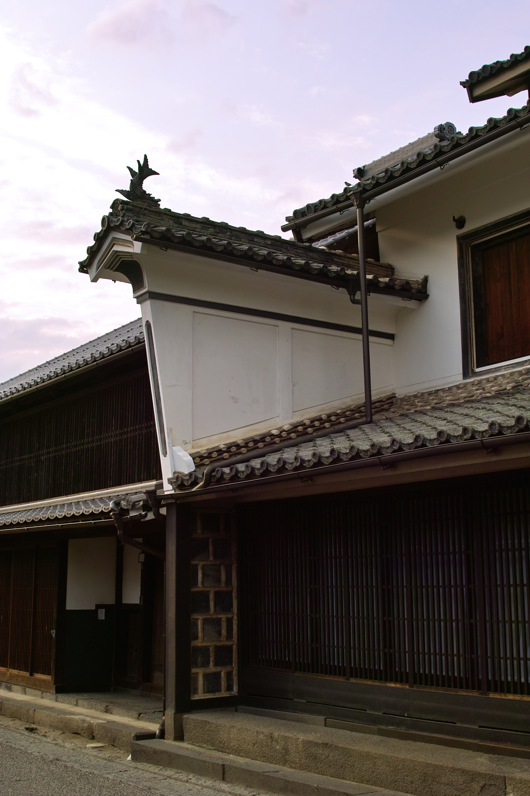
- The udatsu fire wallsraised walls between neighbouring roofs — the full-height kind from the Edo period, the sleeve kind from Meiji
- Unno latticeprojecting first-floor screens with long and short bars set alternately, a pattern particular to this street
- Roof vents and the local museumsmall raised roofs cut for airflow above the silkworm floors, explained inside a former inn on the row
How to actually get there
- Ueda Station → Tanaka Station on the Shinano Railway Line.
- Walk north-west from the station and over the river to the eastern end of the row.
- Start at Shiratori Shrine, then follow the water channel west along the street.
- Finish at the museum, or carry on to Oya Station and take the train from there.
- Shinano Railway to Tanaka
- From Ueda, the shinkansen stop for this part of Nagano, change to the Shinano Railway Line and ride east to Tanaka, the principal station for Tomi. From there the street is about twenty minutes north-west on foot: down off the terrace the station sits on, over the Chikuma River by bridge, and up onto the far bank.
- Back to Tanaka and Ueda
- The same walk and the same line in reverse. This is a local railway and evening services are widely spaced, so pick your return train before you settle into the street. If the walk feels long at the end of the day, taxis can be called from the tourist information point rather than found waiting.
About the place
About a hundred houses still stand along this stretch of the old Hokkoku Road, facing each other across a channel of running water set down the middle of the street. The water and the small stone bridges over it are part of the original arrangement, not landscaping added later. What makes the row unusual is that it carries two trades. The inns of the highway era have deep frontages and heavy timber; the silk houses that replaced them added upper floors and vents, because raising silkworms needs airflow more than it needs space. The buildings were not swapped out between the two eras — they were altered, which is why one facade can show both.
How to enjoy it
Twenty minutes is enough to walk the row and two hours is enough to read it, so treat it as a half-day rather than a day. Give yourself one task: work out for each house whether the upper floor was built for guests or for silkworms, and check your answer against the roof. Guides can be booked in advance through the local tourism association if you would rather be told than guess. The street photographs best under low light at either end of the day, when the fire walls throw shadow across the facades.
Background & history
The post town was opened in 1625, on the Hokkoku Road linking the provinces on the Japan Sea side with the inland route east. Railways took that business away in the Meiji era, and the town answered by turning its inns into silkworm-rearing houses — a change of trade rather than a decline. Recognition came late and twice over: the street was named one of the country's hundred roads in 1986, then designated an Important Preservation District for Groups of Traditional Buildings in 1987, filed under the double heading of post town and silk town.
Before you go
- Cash
- The street itself is free to walk and the car parks are free as well. The museum and the small paying attractions along the row set their own admission and are not always open on the same days, so confirm on arrival. Carry cash: this is a village row, not a shopping street.
- Good to know
- Individual houses keep their own days off and several are private homes that are not open at all, so treat the row as the attraction and anything you get inside as a bonus. Winter here is cold and the street is open to the wind off the river; snow is cleared but the stone edging stays slippery.
- Another way
- Oya, one station further west on the same line, is also about twenty minutes on foot and approaches the row from the other end, which is useful if you want to walk the street once in one direction and leave from the far side. By car the town has three free car parks laid out for the district.
- After you get off
- Leave Tanaka Station on the north side and head north-west. The road runs off the terrace, crosses the river and climbs back a little; the fall and the climb are both slight, and the whole route is paved. You arrive at the eastern end of the row, beside the shrine, which is the right end to start from.
Nearby notes
 くろふね / CC BY 3.0
History · Nagano★★
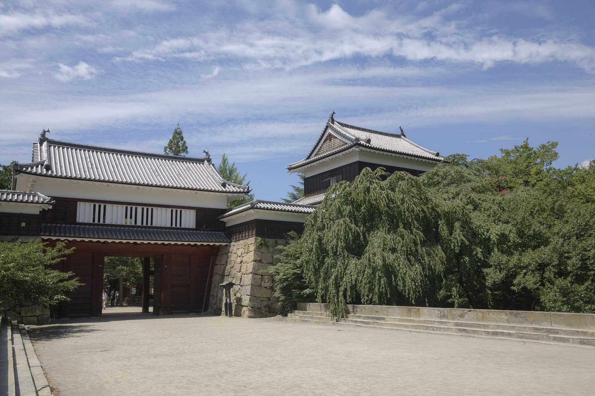
Ueda Castle Ruins Park
7.7 km · straight line
 ほっきー / CC0
Onsen · Nagano★★
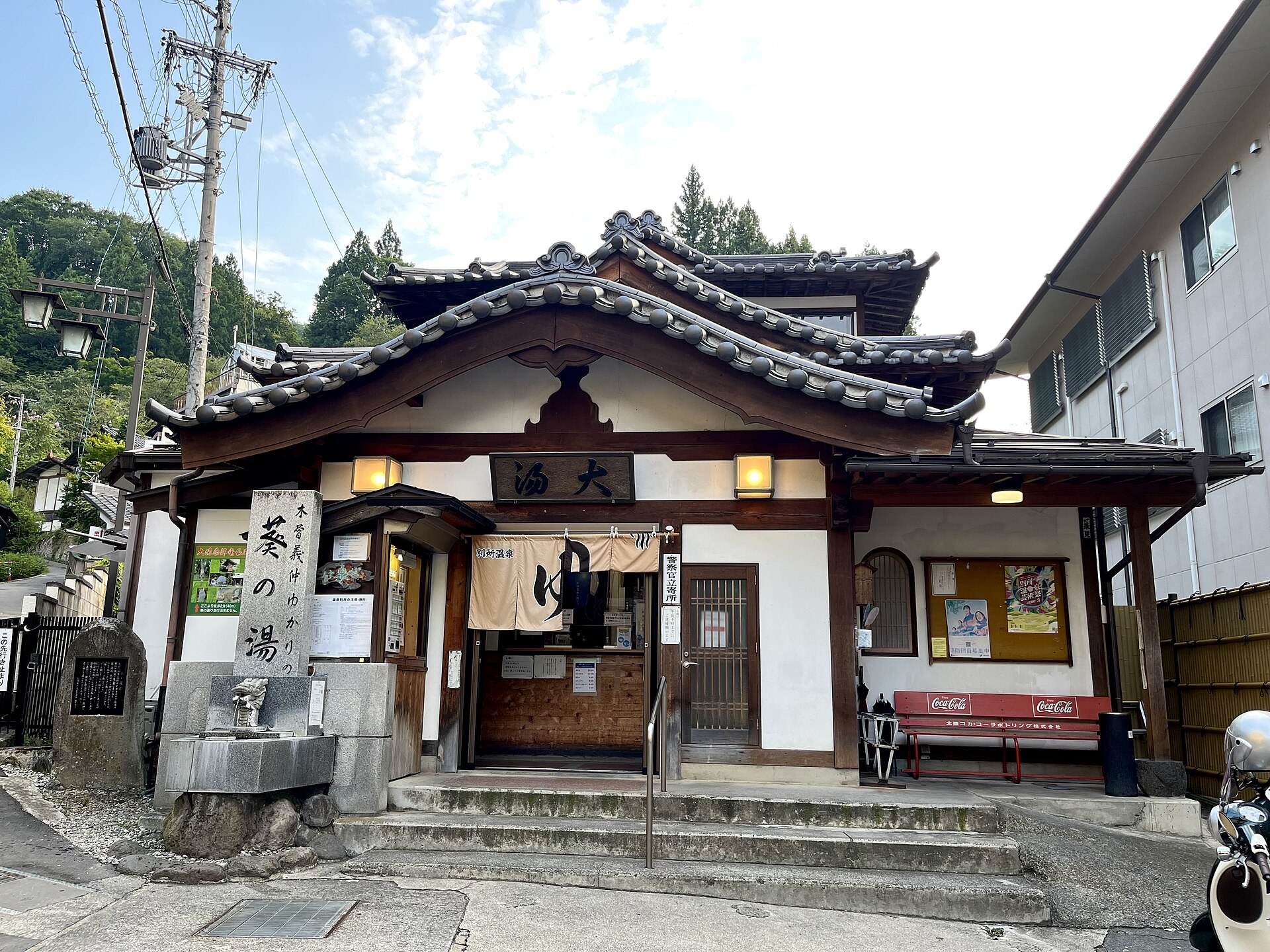
Bessho Onsen
13.8 km · straight line
 On-chan / CC BY-SA 3.0
Food · Gunma★★
Tsumagoi Highland Cabbage
20.6 km · straight line
 osami / Public domain
Nature · Gunma★★
Onioshidashien Lava Park
21.7 km · straight line
Distances are straight lines on the map, not travel times.