North Hokkaido · Rishiri IslandNo.721★★Open in map →
Rishiri Island
A round volcanic island off the northern tip of Hokkaido, built around one peak that starts at sea level and keeps going. The ferry from Wakkanai lands at Oshidomari, and the island's first viewpoint is a walk up the headland beside the pier.
- FromWakkanai Port
- ~1 hr 40 minHeartland Ferry from Wakkanai
- Get off atOshidomari Port Ferry Terminal (Heartland Ferry)
- From there
- Rishiri Island
The sweet spot
Rishiri is not obscure: it is a famous mountain and a famous view, and the summer ferries carry climbers. What is easy to miss is that the climb is optional. The headland beside the ferry terminal gives you the peak, the harbour and Rebun in a single sweep, on a path measured in minutes rather than hours.
Where it is
102 more notes in Hokkaido · open the map →What to look for — in walking order
- Peshi Cape plaza and the Aizu grave markersan open bench of grass partway up the headland, with stone markers for retainers posted to the northern coast
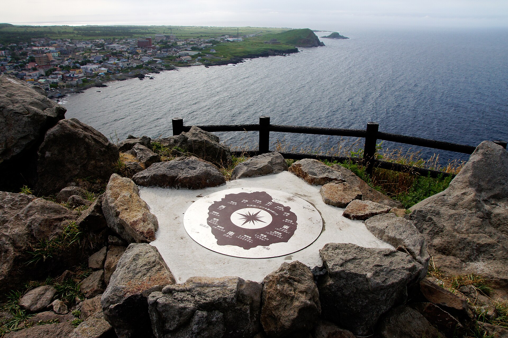
- Cape Peshi lookoutthe top of the rock, with a compass plate and a view over Oshidomari harbour, Rishiri-zan and Rebun Island
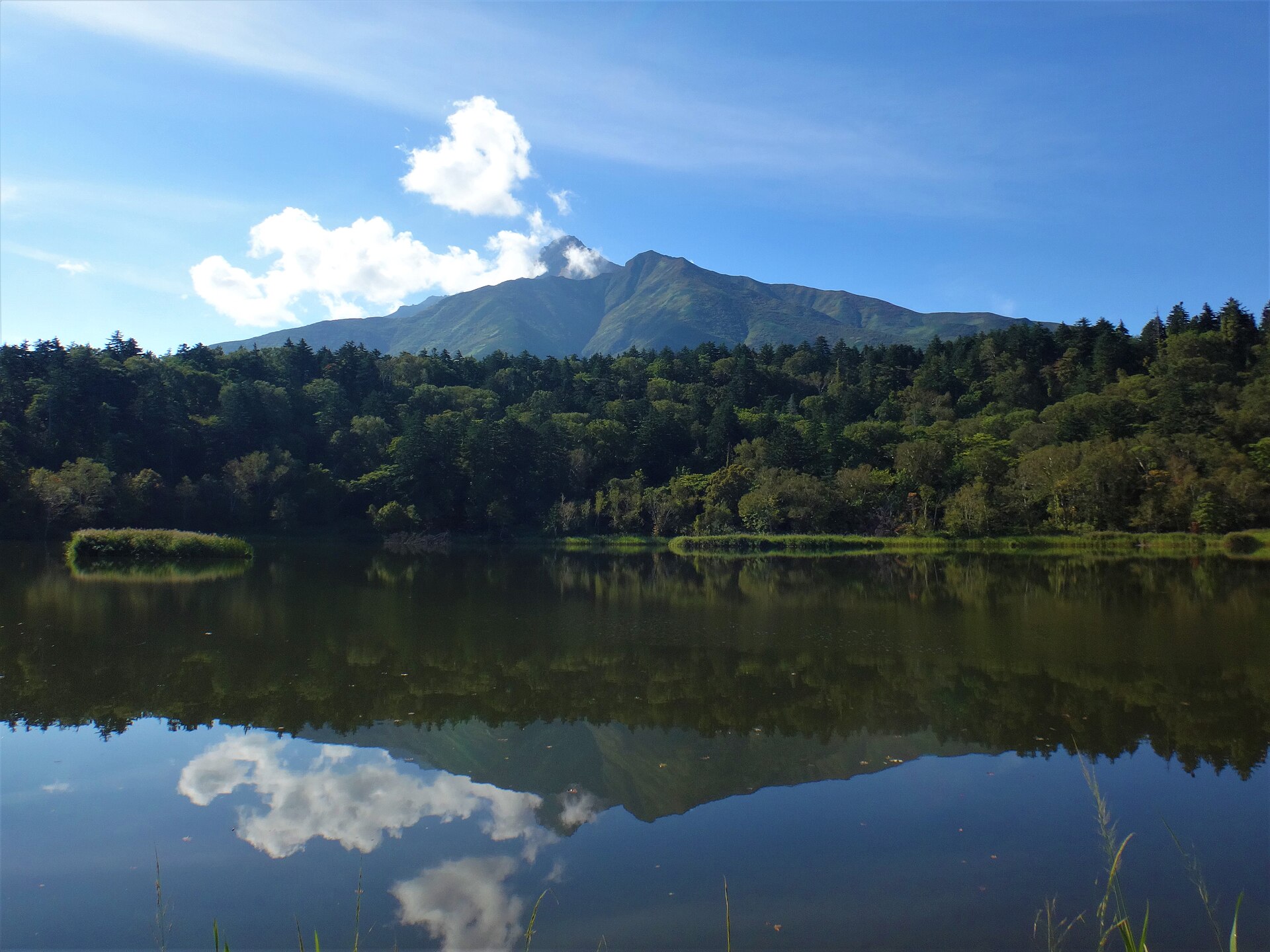
- Himenuma ponda small forest pond east of the port that holds a mirror image of the peak when the water is still
- Oshidomari trailhead for Rishiri-zanthe main way up the mountain, with a portable-toilet collection box standing at the start
How to actually get there
- Wakkanai Port Ferry Terminal → Oshidomari Port, Rishiri Island (Heartland Ferry, about 1 hour 40 minutes).
- From the arrivals hall, walk north along the harbour to the foot of Cape Peshi and pick up the marked path.
- Climb the headland to the lookout, then come down by the second line of the path.
- For the rest of the island, take a bus, a rental bicycle or a car from the port — services are infrequent, so settle the day's route before you land.
- Heartland Ferry from Wakkanai
- Wakkanai is the northern end of the JR Soya Line and the ferry terminal stands by the port. Heartland Ferry crosses to Oshidomari on Rishiri in about 1 hour 40 minutes. There are more sailings in the warmer months than in winter, and the crossing is the only scheduled way onto the island apart from the airport.
- Return sailing to Wakkanai
- The same route runs back. In winter the timetable thins to a couple of crossings a day, and sailings are called off outright in heavy weather. If the trip has to connect with a flight home, build a spare day in rather than trusting a single crossing.
About the place
Rishiri sits in the Sea of Japan west of Wakkanai, inside Rishiri-Rebun-Sarobetsu National Park. The island is essentially one mountain: Rishiri-zan, 1,721 metres, with its skirts running down into the water on every side, which is why maps and locals also call it Rishiri-Fuji. Two towns share it — Rishiri on the west, Rishirifuji on the east — and the ferry port of Oshidomari sits on the northeastern shore. Just north of the port a green rock headland called Cape Peshi juts into the sea. A footpath climbs it, and that path is the shortest route to a full view of the island.
How to enjoy it
Give the headland an hour. The path splits into two lines near the bottom, so you can climb by one and come down the other, and the whole loop starts a short walk north of the arrivals hall. If you are crossing to Rebun the same day, the walk fits neatly into the gap between sailings — read the departure board before you start up.
Background & history
Rishiri-zan built the island from the sea floor upward, and its ridges now carry plants that grow nowhere else, among them the Rishiri poppy and the Rishiri milkvetch. The island, neighbouring Rebun and the Sarobetsu wetlands on the facing mainland were later grouped into a single national park at the northern end of the country. On Cape Peshi, above the harbour, a lighthouse marks the entrance and the path to it passes stone markers for Aizu retainers sent north on coastal guard duty.
Before you go
- Cash
- The headland path and the lookout are free and open. Ferry tickets are sold at the terminal counters and the operator publishes the current fare table on its site. The tourist information desk at the port handles island maps and trail conditions.
- Good to know
- The headland is exposed and the wind off the sea is constant; in snow and ice the upper section is not a walk to attempt. Ferries stop for weather. On the mountain itself, the town asks every climber to carry a portable toilet and leave it in the collection box at the trailhead, and the same rule applies on the Himenuma path.
- Another way
- The island has its own airport, with flights from Sapporo. A second Heartland Ferry route links Oshidomari with Kafuka on Rebun, so most people arrive from one side and leave from the other rather than doubling back to Wakkanai.
- After you get off
- Oshidomari Port Ferry Terminal is the island's arrival hall and its transport hub. Turn north out of the building and follow the harbour road; the green rock of Cape Peshi stays in front of you the whole way to the path.
Nearby notes
Distances are straight lines on the map, not travel times.