Tokushima · MugiNo.651★★Open in map →
Tebajima Fishing Village
— An island off Mugi with a listed fishing quarter
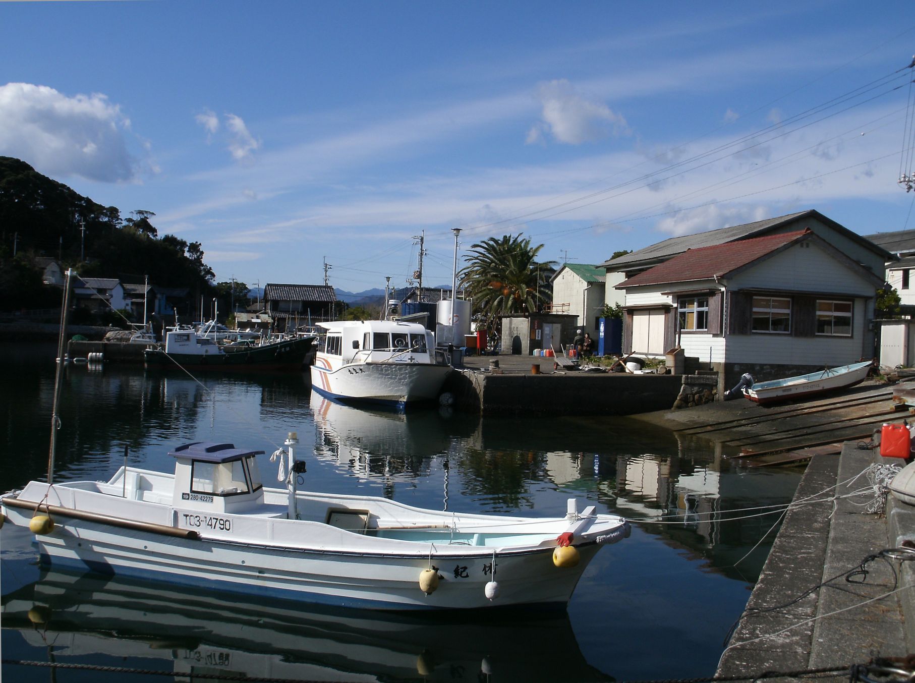
A small island south of Mugi where an entire fishing village, built from the late Edo period onward, still stands around one harbour. It is a national preservation district, there are no cars on it, and the crossing from the mainland is short.
- FromMugi Station
- ~25 minJR then a short boat
- Get off atTebajima Port (boat from Mugi Port)
- From there
- Tebajima Fishing Village
The sweet spot
Tebajima is on the map: it is listed nationally, and the repaired houses have been used for an island art show. What filters the place is the water. Day visitors arrive and leave in a block with the boat, so the village is at its calmest in the stretch between sailings, when the lanes belong to the people who live along them.
Where it is
13 more notes in Tokushima · open the map →What to look for — in walking order
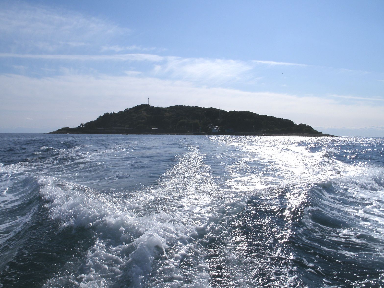
- Tebajima Portthe horseshoe harbour where the boat ties up, with the village standing directly behind the quay
- Nishihato and Honmachithe older run of townhouse-type fishermen's homes, front doors opening almost onto the water
- Shinmachithe quarter laid out on ground reclaimed after the Ansei earthquake, on a straighter grid than the rest
- Oike pondthe inland pond whose shiratamamo stonewort colony is a national natural monument
- Tebajima Lighthousethe far end of the island loop path, with open water on three sides and the Shikoku range back to the north
How to actually get there
- Mugi Station → Mugi Port (a short walk through the town).
- Mugi Port → Tebajima Port (Mugi Town boat, about 15 min).
- Tebajima Port → the Nishihato and Honmachi lanes, then Shinmachi on the reclaimed ground.
- Village → Oike pond and the island loop path to the lighthouse, then back to the pier.
- JR Mugi Line, then the island boat
- Mugi Station sits at the far end of the useful run down the Tokushima coast; from the platform it is a short walk through the town to Mugi Port, where the Tebajima boat leaves from the quay. The crossing is the only way onto the island. The town publishes the sailing times and the fare together, so both can be checked before you travel.
- Return on the same boat
- Sailings back from Tebajima finish in the afternoon, earlier than most people assume of a day trip, so fix your return before you start wandering the lanes. Trains north from Mugi also thin out toward evening; check both halves of the journey while you are still on the mainland.
About the place
Tebajima lies in open water south of Mugi, and its village fills the horseshoe of an inlet on the island's north side. The preservation district covers about 3.7 hectares, packed so tightly that house fronts nearly touch and the lanes behind them are barely wider than a doorway. Its sub-quarters still carry separate names — Nishihato, Honmachi, Shinmachi, Subana — because each marks a different stage in how the village grew. What stands here is not a reconstruction; these are the houses of a working fishing community, in a row. Nothing has a road to drive on, so goods still move by handcart.
How to enjoy it
The crossing takes about fifteen minutes and the Mugi side runs six sailings a day, which is really the shape of a visit here: choose your boat out and your boat back first, then let the island fill the gap between them. An unhurried circuit of the lanes and the loop path fills the middle of the day comfortably. The last return leaves in the afternoon, so this is a day that ends early rather than one that stretches into the evening.
Background & history
The island was settled in earnest in the late Edo period, when the Tokushima domain encouraged families to move out to it. Bonito fishing paid for what followed, and the village expanded in stages around the harbour; after the Ansei earthquake part of the shore was filled in and laid out as a new quarter on a straighter plan. Houses from the closing decades of Edo through the early Showa years survive in numbers, which is rare for a fishing settlement anywhere. In 2017 the quarter was listed nationally, recorded under the fishing-village category.
Before you go
- Cash
- Walking the village costs nothing — the lanes are public. The boat fare is the one charge, published by the town alongside the timetable, and it is set higher for a stretch of the summer, so read the current column rather than an old one.
- Good to know
- The village is lived in and the lanes pass directly in front of doorways: keep noise down, and do not step into entrances or work yards. The crossing is open Pacific water, so weather can affect it. A tsunami evacuation tower stands above the houses, which tells you plainly what coast this is.
- Another way
- Drivers come down National Route 55 along the coast and leave the car at Mugi Port — there is nowhere to take it on the island. Mugi also sits on the run south toward Kaiyo, so the crossing slots into a longer day along the southern Tokushima shore.
- After you get off
- The boat ties up inside the harbour and the village is already there: house fronts face the quay and the lanes lead straight off it. The whole preservation district is flat ground within a few minutes of the landing. Only the path toward the lighthouse climbs, and it climbs gently.
Nearby notes
Distances are straight lines on the map, not travel times.