Kitakyushu · Kokura SouthNo.1086★★Open in map →
Hiraodai Karst Plateau
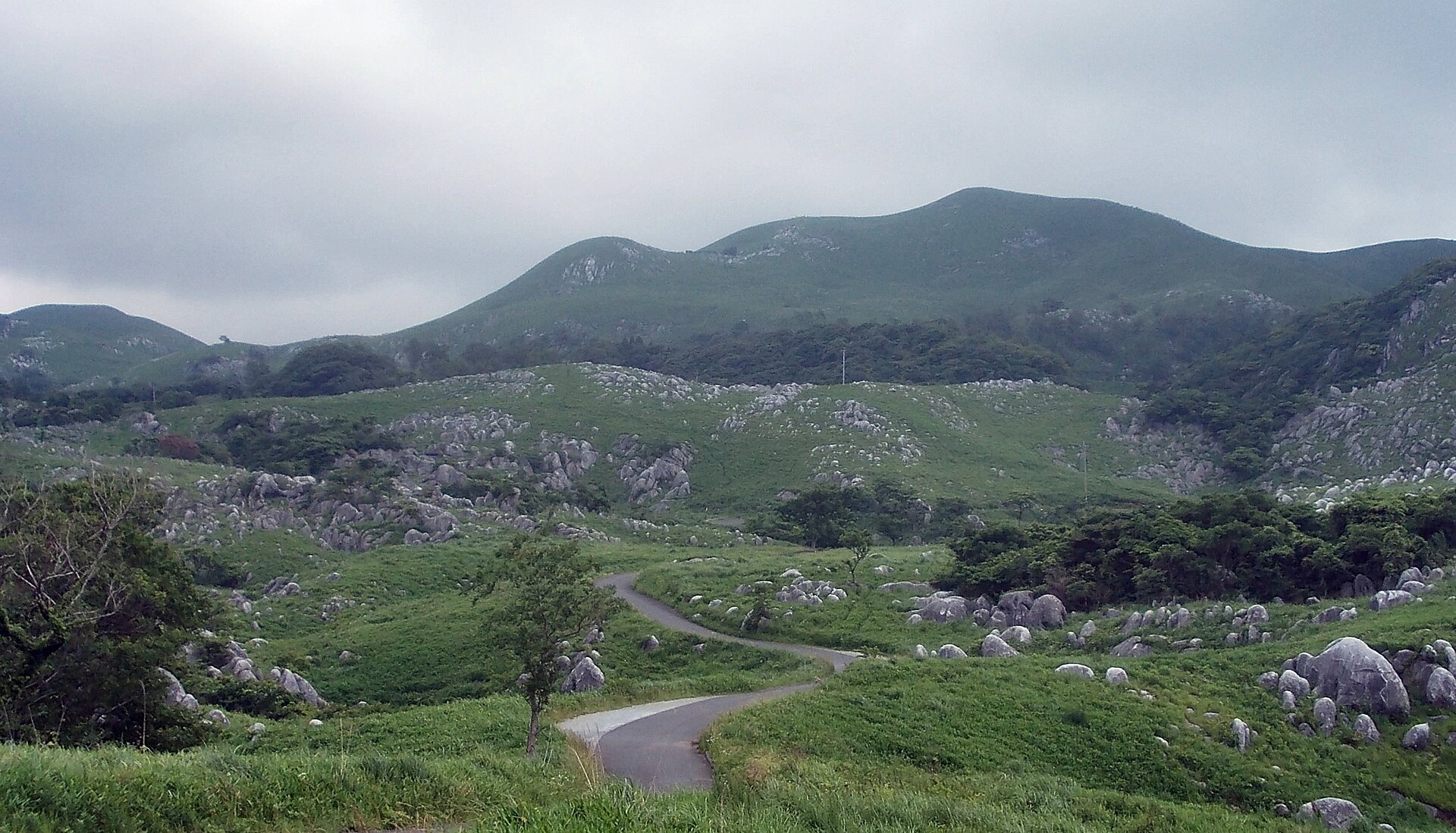
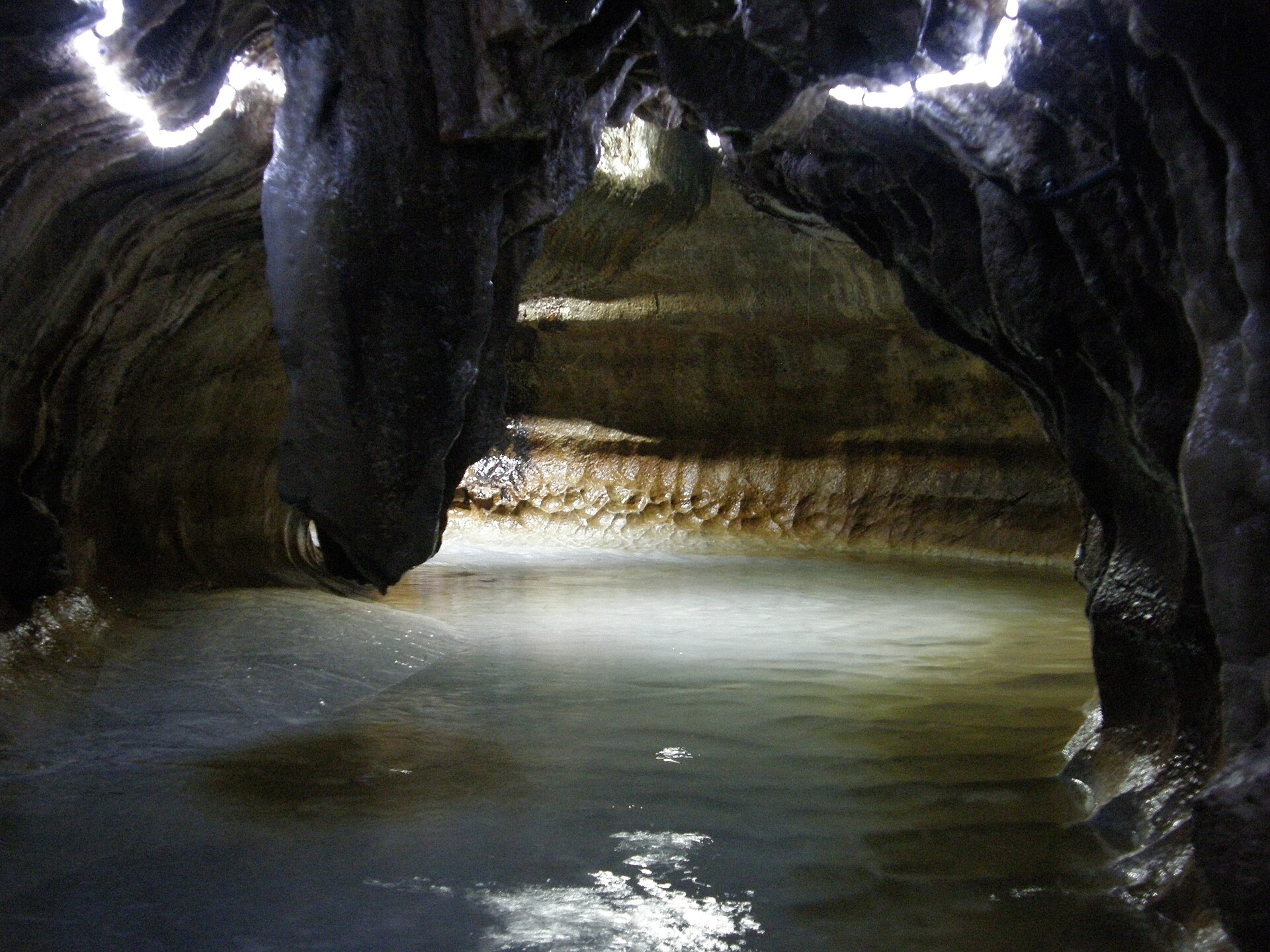
A limestone plateau on the southern edge of Kitakyushu, where pale rock stands out of open grassland that people keep open by burning it. Show caves run underneath, and the largest one turns into a stream you wade rather than a path you walk.
- FromKokura Station
- ~70 minJR train, then shared taxi
- Get off atIshihara-machi Station (JR Hitahikosan Line)
- From there
- Hiraodai Karst Plateau
The sweet spot
Hiraodai is well known across Kyushu and the plateau road carries steady traffic on a fine weekend, so this is not an overlooked corner. Two things do get missed. The grassland is half made by people and would close over into forest without the annual burn. And the public way up is a shared taxi that keeps a seasonal, weekend timetable, so the plateau is always there while the ride is not.
Where it is
28 more notes in Fukuoka · open the map →What to look for — in walking order
- Hiraodai Nature Observation Centrea free exhibition hall on the karst and its wildlife, and the shared taxi's last stop
- Yogunbaruopen grass studded with pale limestone pinnacles, the flock-of-sheep view of the plateau
- Mount Ohiraa rounded summit above the pinnacle slopes, with the plateau laid out below it
- Senbutsu-shonyudothe show cave east of the centre, where the floor becomes a stream 480 metres in
How to actually get there
- Kokura Station → Ishihara-machi Station (JR Hitahikosan Line).
- Ishihara-machi Station → Hiraodai Nature Observation Centre (city shared taxi, or an ordinary taxi).
- Centre → Yogunbaru → Mount Ohira along the grassland paths, then back to the centre.
- Centre → Senbutsu-shonyudo, east along the plateau road, for the lit passage and the stream walk.
- JR Hitahikosan Line to Ishihara-machi, then the shared taxi
- Kokura Station →(JR Hitahikosan Line)→ Ishihara-machi Station. From the station the city's shared-taxi service climbs onto the plateau and sets down at the Hiraodai Nature Observation Centre; Fukuoka Prefecture's official guide puts that road stage at about twenty minutes. The Hitahikosan Line is a branch line rather than one of the main lines through Kokura, so read the return departures on the board before you leave the platform. Allow roughly seventy minutes from Kokura, and more if you are waiting on a connection.
- Back down to Ishihara-machi
- The same shared taxi runs from the observation centre down to Ishihara-machi Station, and outside its operating hours an ordinary taxi is the only way off the plateau. Kitakyushu City runs the fixed service on weekends and public holidays from the spring equinox to the end of November; at other times it works on advance booking with a minimum group size. A solo traveller on a winter weekday should settle the return before going up. From Ishihara-machi the line runs back into Kokura.
About the place
Hiraodai is a limestone plateau lifted above the southern edge of Kitakyushu, inside the Kitakyushu Quasi-National Park. Grey-white rock breaks through the turf in loose clusters, and that view has long been called Yogunbaru, the flock-of-sheep field. Water has been working the same limestone from below for far longer, and the plateau is undercut by caves. Three of them are open to visitors. The largest, Senbutsu-shonyudo, is lit for 900 metres, and the far half of that is a stream you step into rather than a floor you walk on. The Hiraodai Nature Observation Centre stands in the middle of the grassland and makes the obvious place to begin.
How to enjoy it
Call at the observation centre first, then get out onto the grass while the light is still high enough to separate white rock from green turf. The centre keeps daytime hours and closes one day a week, so that is the one thing worth confirming in advance. Save the cave for the hottest part of a summer day or the coldest part of a winter one: the air inside holds around 16°C and the water around 14°C all year, which makes it air conditioning in one season and shelter in the other.
Background & history
The limestone began as the remains of shallow-sea life and was later altered by heat when granite pushed into it, which is why fossils are not found in it here. Senbutsu-shonyudo was listed as a national natural monument in 1935, and the plateau itself followed in 1952. What the listings protect is not untouched ground. Kitakyushu City describes the grassland as half natural, and the yearly burning is carried out to improve the pasture, hold insects down and stop fire spreading into the woods below.
Before you go
- Cash
- The observation centre is free to enter. The shared taxi charges a flat fare per person and is paid in cash. The show caves are privately run, and each operator sets its own admission and its own opening hours, so check the operator's own page rather than a guidebook. There is nothing on the plateau on the scale of a station concourse, so carry cash and something to drink.
- Good to know
- The grassland is burned off in late winter and Kitakyushu City closes roads around the plateau on the burn day, so check the notices before travelling in February or March. Up on the plateau there is little shade and the wind comes through unbroken. Inside Senbutsu-shonyudo the far section is a wade in cold water; footwear is lent at the entrance, but wear trousers you can roll above the knee, and think twice if you are carrying anything that has to stay dry.
- Another way
- By road the plateau is reached from the Kokura-minami interchange on the Kyushu Expressway or the Yukuhashi interchange on the Higashi-Kyushu Expressway, and a car makes the caves at the eastern edge easy to add. Without a car there is a second public route: Nishitetsu bus to Nakatani, then the same shared-taxi service up to the plateau.
- After you get off
- Ishihara-machi Station sits below the plateau, not on it. The last stage is a climb by road and is made by shared taxi or ordinary taxi rather than on foot. The shared taxi sets down at the observation centre, and the grassland paths start at its door.
Nearby notes
 そらみみ (Soramimi) / CC BY-SA 4.0
Nature · Fukuoka★★
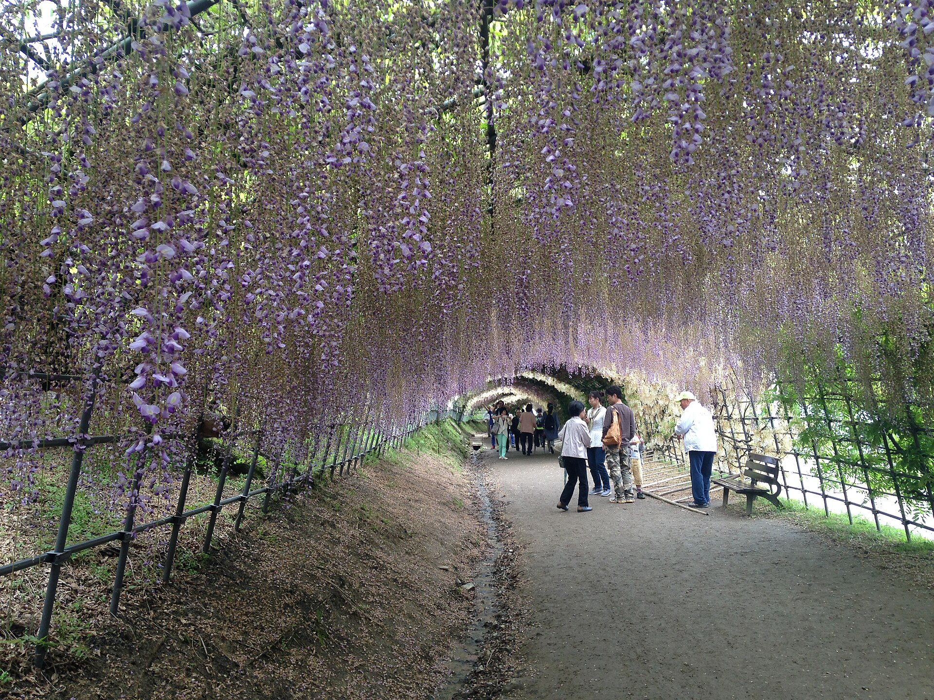
Kawachi Fujien Wisteria Garden
12.6 km · straight line
 Suicasmo / CC BY-SA 4.0
Nature · Fukuoka★★
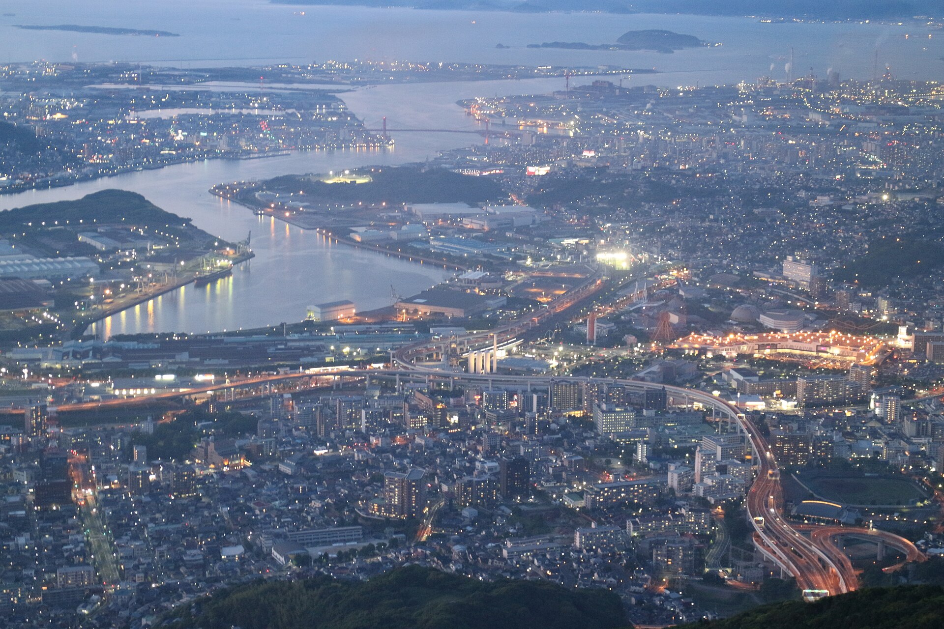
Mount Sarakura
13.5 km · straight line
 Suicasmo / CC BY-SA 4.0
Local life · Fukuoka★★
Kokura Castle & Tanga Market
14.4 km · straight line
 663highland / CC BY 2.5
History · Fukuoka★★★
Mojiko Retro
21.9 km · straight line
Distances are straight lines on the map, not travel times.