Southwest Kochi · OtsukiNo.871★★Open in map →
Kashiwajima Island
— Kochi's clearest water, at the prefecture's western tip
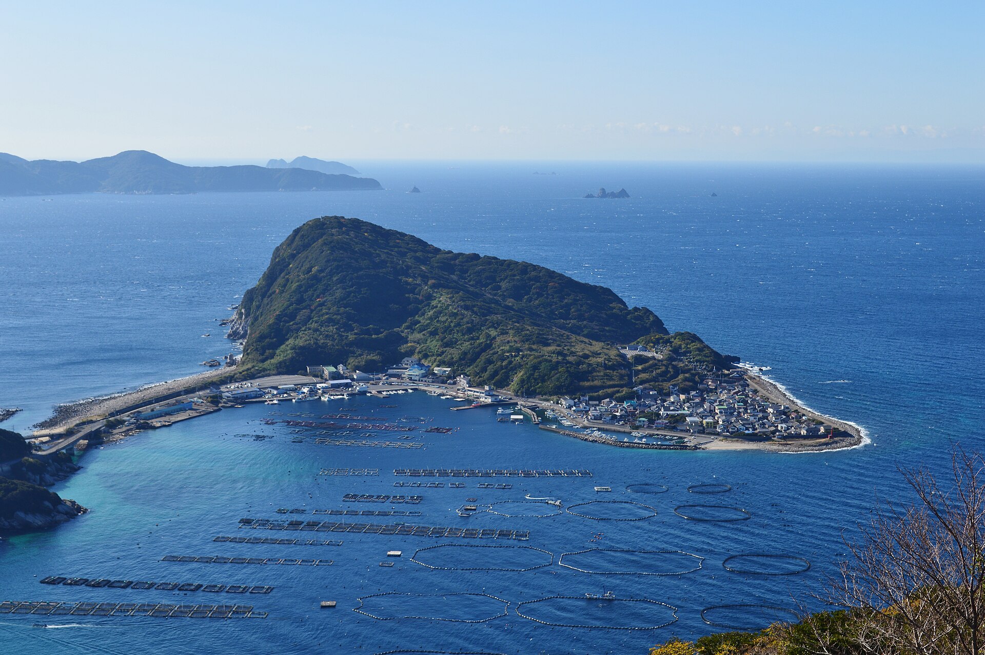
Kashiwajima sits at the far southwestern corner of Kochi, joined to the mainland by two short bridges. The Kuroshio current meets the Bungo Channel offshore, the water over the harbour is startlingly clear, and the island is still a working fishing village.
- FromSukumo Station
- ~45 minBus from Sukumo, ~45 min
- Get off atKashiwajima (Kochi Seinan Kotsu bus)
- On foot
- Kashiwajima Island
The sweet spot
Kashiwajima is not a secret; it is one of Japan's best-known dive sites. The surprise is how ordinary it is above the waterline — narrow lanes, nets and floats, a post office. The rules on parking and swimming exist because the summer crowd outgrew the island a long time ago.
Where it is
19 more notes in Kochi · open the map →What to look for
- The bridges onto the islandtwo crossings from the mainland, with clear water directly beneath the newer one
- Kashiwajima harbourworking berths and a bay ruled off by aquaculture pens, best read from the road above
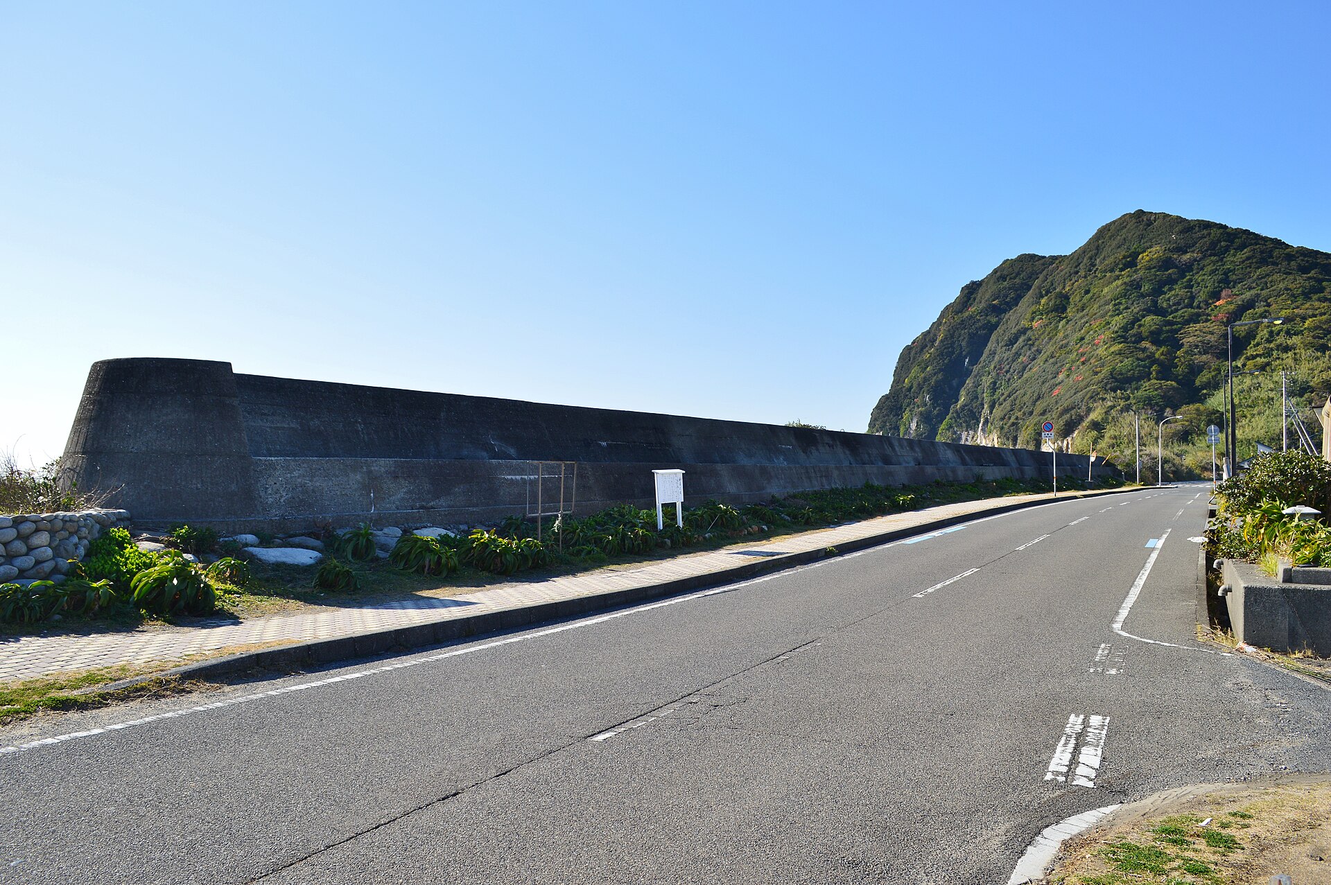
- The Kashiwajima stone breakwatera dry-stone sea wall along the anchorage, raised in the Edo period to shelter boats
- Kashiwajima visitor information centrethe island's information point and paid car park, staffed through the summer season
- Shirahama beacha natural beach on the island, shallow enough to snorkel over coral and small reef fish
How to actually get there
- Sukumo Station → Kashiwajima (Kochi Seinan Kotsu bus, Kashiwajima line).
- Cross onto the island and walk the harbour front past the old stone breakwater.
- Call at the visitor information centre for the car park, the swimming areas and the day's notices.
- Walk on to Shirahama for shallow snorkelling, then back to the bus stop in the village.
- Bus from Sukumo Station
- Sukumo Station →(Kochi Seinan Kotsu, Kashiwajima line)→ Kashiwajima, roughly 45 minutes by road. Sukumo is the western terminus of the Tosa Kuroshio Railway and the practical railhead for this corner of the prefecture. Buses are few, so check the departure before you commit the day to it.
- Return from the island
- The same line runs back toward Sukumo, and the last service is early by city standards. Otsuki town also runs a community bus between Kashiwajima and Fureai Otsuki. Fix your return before you get in the water.
About the place
The island is small enough to walk around: roughly four kilometres of shoreline, with about four hundred people living on it. Fishing is the business. The bay is ruled off into rings and squares of aquaculture pens, and the harbour front belongs to boats before it belongs to visitors. The water is what brings everyone else. The Kuroshio current meets the Bungo Channel offshore, and the town and the prefecture both say that around a third of the fish species found in Japanese waters turn up here. The local phrase for the clarity is that boats look as though they are hanging in mid-air. Two bridges carry the road across, so nobody waits for a ferry.
How to enjoy it
Summer is when the swimming areas are marked and the information centre is open, and it is also when the island is fullest and the parking rules bite hardest. Outside the season the water is just as clear and the lanes are quiet, though facilities close. Near rocks, watch for long-spined sea urchins.
Background & history
Before the bridges, everything came and went by boat. The shelter of the anchorage is older still: a dry-stone sea wall along the harbour was raised as a domain project in the Edo period, credited to the Tosa administrator Nonaka Kenzan. In the second half of the twentieth century a road bridge, and then a second and larger crossing, tied the island to the mainland. Diving arrived after that, and turned a fishing village into a destination as well as a workplace.
Before you go
- Cash
- The island itself costs nothing to visit. The car park by the visitor information centre is charged during the summer season, and the shops on the island are small, so bring cash rather than assume card or IC.
- Good to know
- Otsuki town asks visitors to use the paid car park instead of the roadside, to swim only inside the marked buoys, not to jump from the bridge, and to carry rubbish away. Parking bans and traffic control apply in the busy season, and the information centre only opens for the summer.
- Another way
- By car, the island is about forty minutes from the Sukumo-Wada interchange on the Nakamura–Sukumo road. The coast road narrows in places and queues in high summer.
- After you get off
- From the Kashiwajima bus stop in the village, the harbour front, the stone breakwater and the information centre are all within a few hundred metres on foot.
Nearby notes
 ブルーノ・プラス / CC BY 4.0
Local life · Kochi★★
Okinoshima
8.0 km · straight line
 松岡明芳 / CC BY-SA 3.0
Local life · Ehime★★
Sotodomari Stone-Walled Village
23.0 km · straight line
Distances are straight lines on the map, not travel times.