Southwest Ehime · AinanNo.650★★Open in map →
Sotodomari Stone-Walled Village
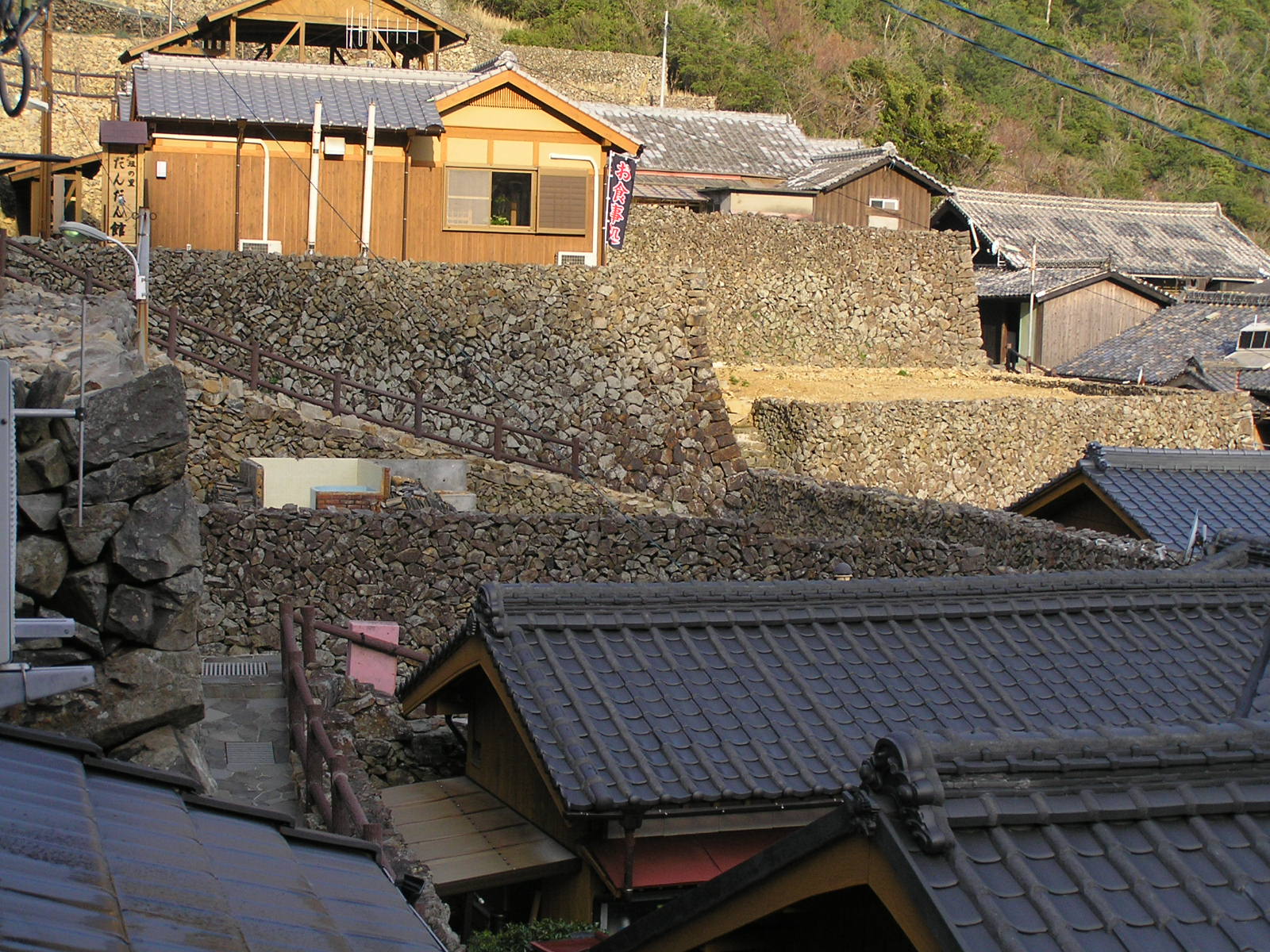
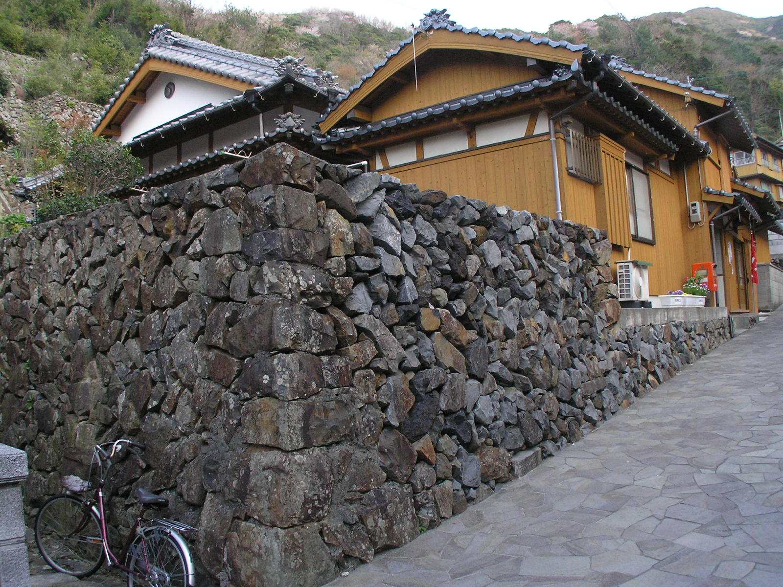
A fishing village in a west-facing inlet of the Nishiumi peninsula, where houses stand behind dry-stone walls stacked as high as their eaves. The walls are wind protection built by the residents themselves, and the village is still lived in.
- FromUwajima Station
- ~1 hr 45 minUwajima Bus, change at Misho
- Get off atSotodomari (Uwajima Bus, via Misho)
- From there
- Sotodomari Stone-Walled Village
The sweet spot
Sotodomari appears on several national lists of scenic villages, so it is documented rather than secret. It stays quiet because it is a dead-end inlet on a peninsula with no railway, close to two hours from Uwajima by bus. It also has almost no visitor infrastructure now that the village rest house has closed, which means nothing here is arranged for an audience.
Where it is
29 more notes in Ehime · open the map →What to look for — in walking order
- The shore lanethe road along the inlet, with the fishing harbour on one side and the first walls rising on the other
- Tomi-no-mado sightlinesrecesses left in the stonework so a house could watch the sea and the boats coming home
- The eaves-high wallsthe exposed western faces, where the stone is stacked as high as the roofline
- The stepped upper lanesnarrow flights climbing between the plots to the highest houses on the slope
- The view back over the inletboats, fish pens and the opposite shore, seen from above the top row of roofs
How to actually get there
- Uwajima Station → Misho (Uwajima Bus toward Shirokata and Sukumo, about 1 hr 15 min).
- Misho → Sotodomari (change to the Sotodomari service, about 30 min, to the end of the line).
- Walk the shore lane, then climb the stepped lanes between the walls to the top row of houses.
- Come back down the same way in time for your return connection at Misho.
- Uwajima Bus via Misho
- JR Uwajima Station →(Uwajima Bus toward Shirokata and Sukumo, about 1 hr 15 min)→ Misho, change to the Sotodomari service →(about 30 min)→ Sotodomari at the end of the line. Both legs are rural services with few runs, so check the timetable in each direction before you set out.
- Return from Sotodomari
- The same two legs run in reverse, with a change back at Misho. The connection at Misho governs everything, so note your pair of return departures at the stop before you walk up into the village.
About the place
Sotodomari occupies a west-facing inlet on the Nishiumi peninsula, at the south-western tip of Ehime. Houses climb the slope above the water in tight rows, and each one stands behind a wall of stacked stone. On the exposed sides those walls rise to the eaves, high enough to break the typhoon winds and the salt-laden gales that come off the open sea in winter. Residents built them by hand as they cleared and terraced their own plots. Lanes and stepped paths thread between the walls, and from the upper rows the inlet and its boats sit directly below.
How to enjoy it
Come in daylight and walk slowly, because the point of the place is at eye level, in the joints of the stonework and the gaps left for sightlines. Allow more time than the size of the village suggests, since the climb to the top lanes and back is all steps. There is no cafe or information desk here now, so carry water.
Background & history
The village began as an overflow. At the end of the Edo period the neighbouring settlement of Nakadomari had outgrown its ground, and younger sons were offered land in the next inlet to the west. The families who took it filled the valley floor to make house plots, terraced the slope and built their own retaining and shelter walls. In 2007 the Ancient Capitals Preservation Foundation listed Sotodomari among a hundred historic landscapes of Japan, and the village also holds an agriculture ministry award and a place on a national list of fishing-village heritage.
Before you go
- Cash
- There is no admission and no ticket office. The lanes are public roads through a lived-in village. Free parking is provided for drivers. Bring cash, and since the rest house has closed, bring your own water and food as well.
- Good to know
- People live here. Stay on the lanes and public steps, do not enter yards or photograph into windows, and keep your voice down early and late. The paths are steep and uneven, and the western face of the village takes the wind straight off the sea.
- Another way
- By car, the peninsula is reached from the Matsuyama Expressway at Seiyo-Uwa, then south on National Route 56 and out along the Nishikai road.
- After you get off
- Sotodomari is the last stop on the line. The bus sets you down beside the inlet, and the first walls begin a short walk up the shore lane.
Nearby notes
 皓月旗 / CC BY-SA 4.0
Local life · Ehime★★
Iwamatsu Historic Townscape
21.2 km · straight line
 Saigen Jiro / CC0
Nature · Kochi★★
Kashiwajima Island
23.0 km · straight line
 ブルーノ・プラス / CC BY 4.0
Local life · Kochi★★
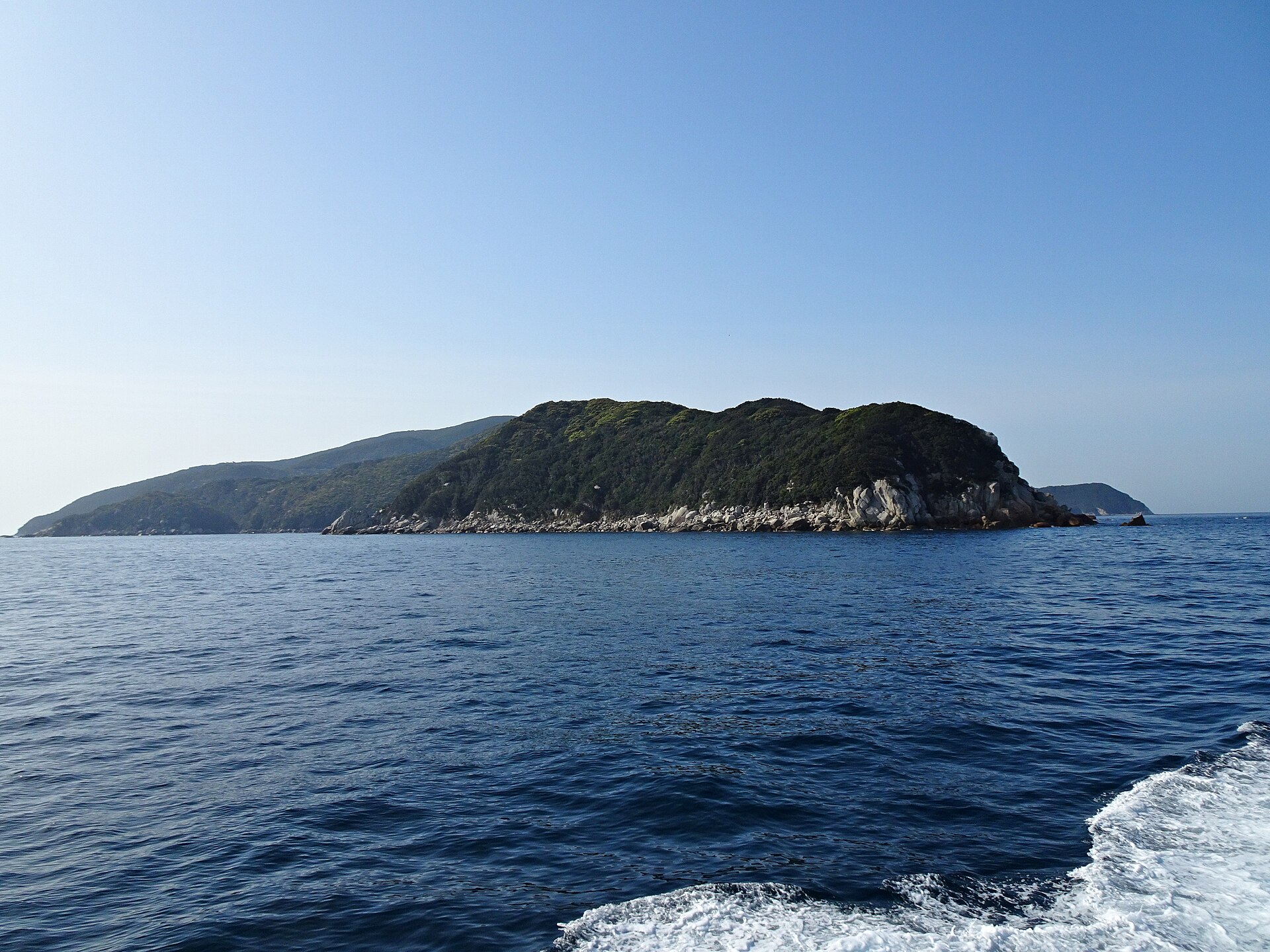
Okinoshima
24.4 km · straight line
Distances are straight lines on the map, not travel times.