Central Okinawa · UrumaNo.799★★Open in map →
Henza and Miyagi Islands
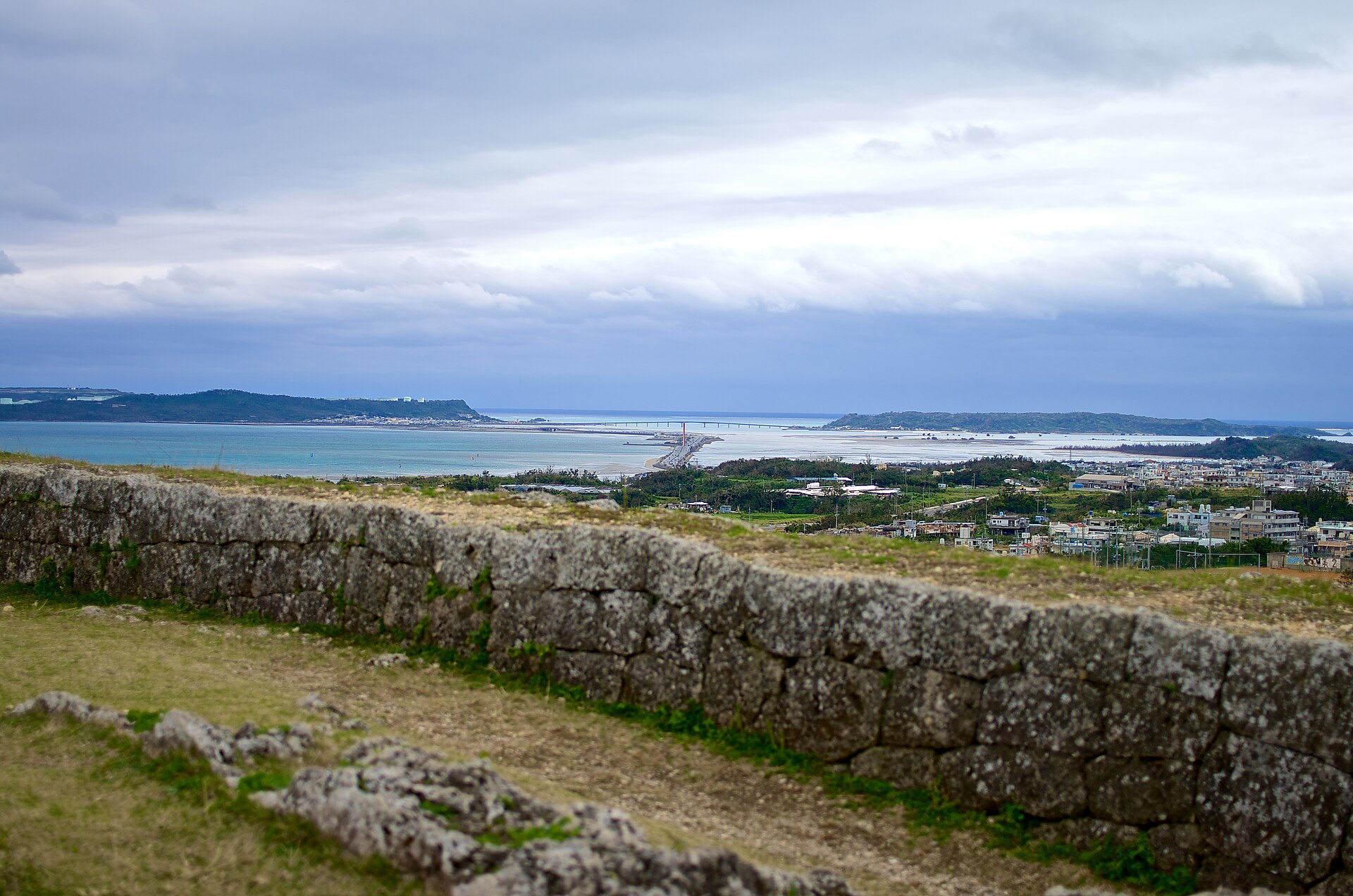
Two islands off Okinawa's east coast, reached by a road built straight across the reef. Henza carries an oil terminal and a village on a sand spit; Miyagi rises into a farmed tableland with cliffs above the sea.
- FromNaha
- Half a dayBus to Yakena, then car
- Get off atYakena Bus Terminal (Uruma, Katsuren peninsula)
- From there
- Henza and Miyagi Islands
The sweet spot
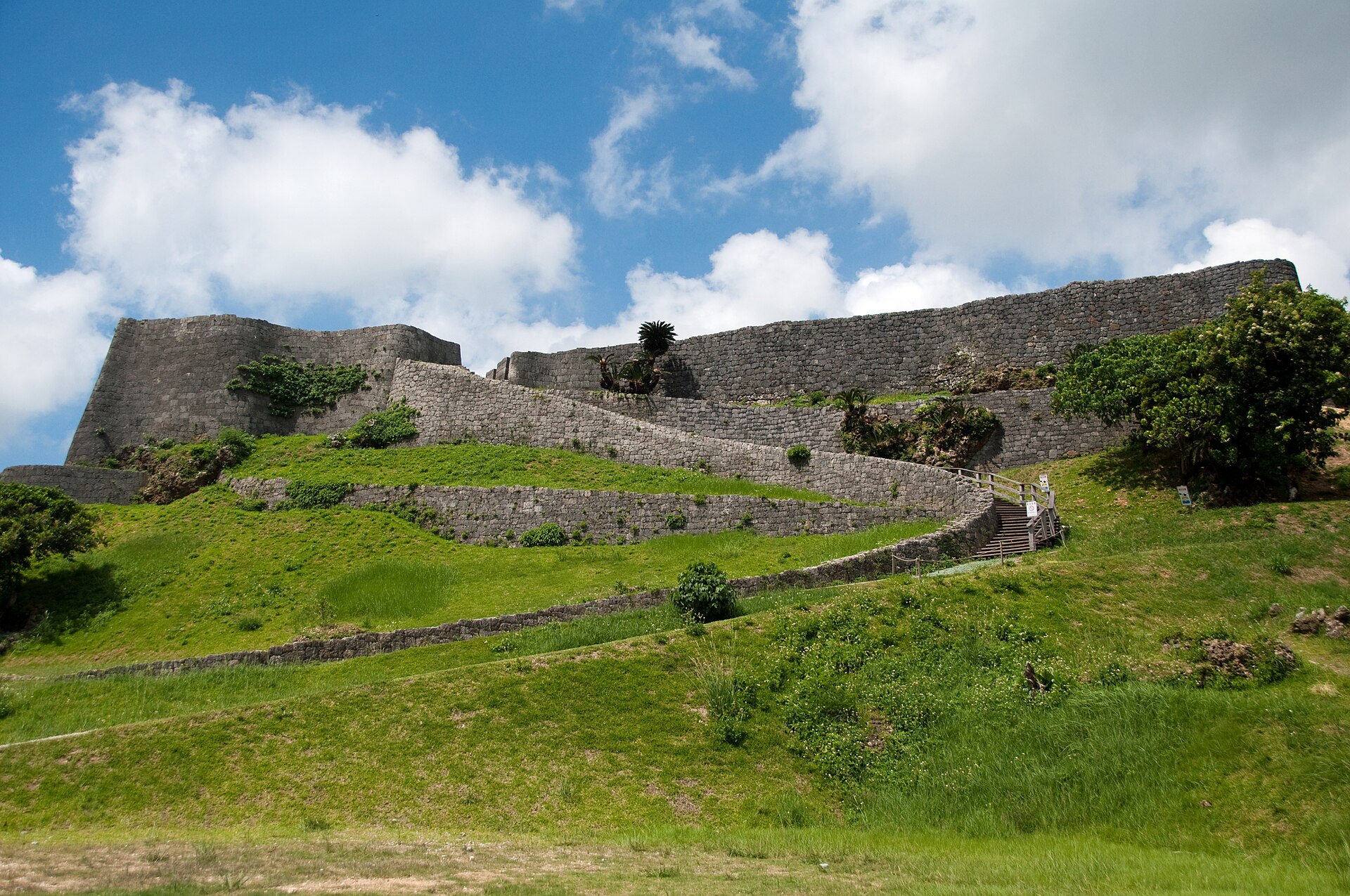
These islands are not overlooked by accident. They sit past a famous castle ruin and past the island everyone visits for its creation-myth shrines, and most people turn off before they reach them. The tanks put others off, which is hard on the fields and cliffs behind them.
Where it is
41 more notes in Okinawa · open the map →What to look for — in walking order
- Umi-no-Eki Ayahashi-kanrest station at the midpoint of the causeway, built in the shape of a Ryukyuan trading ship, with the city's maritime museum upstairs
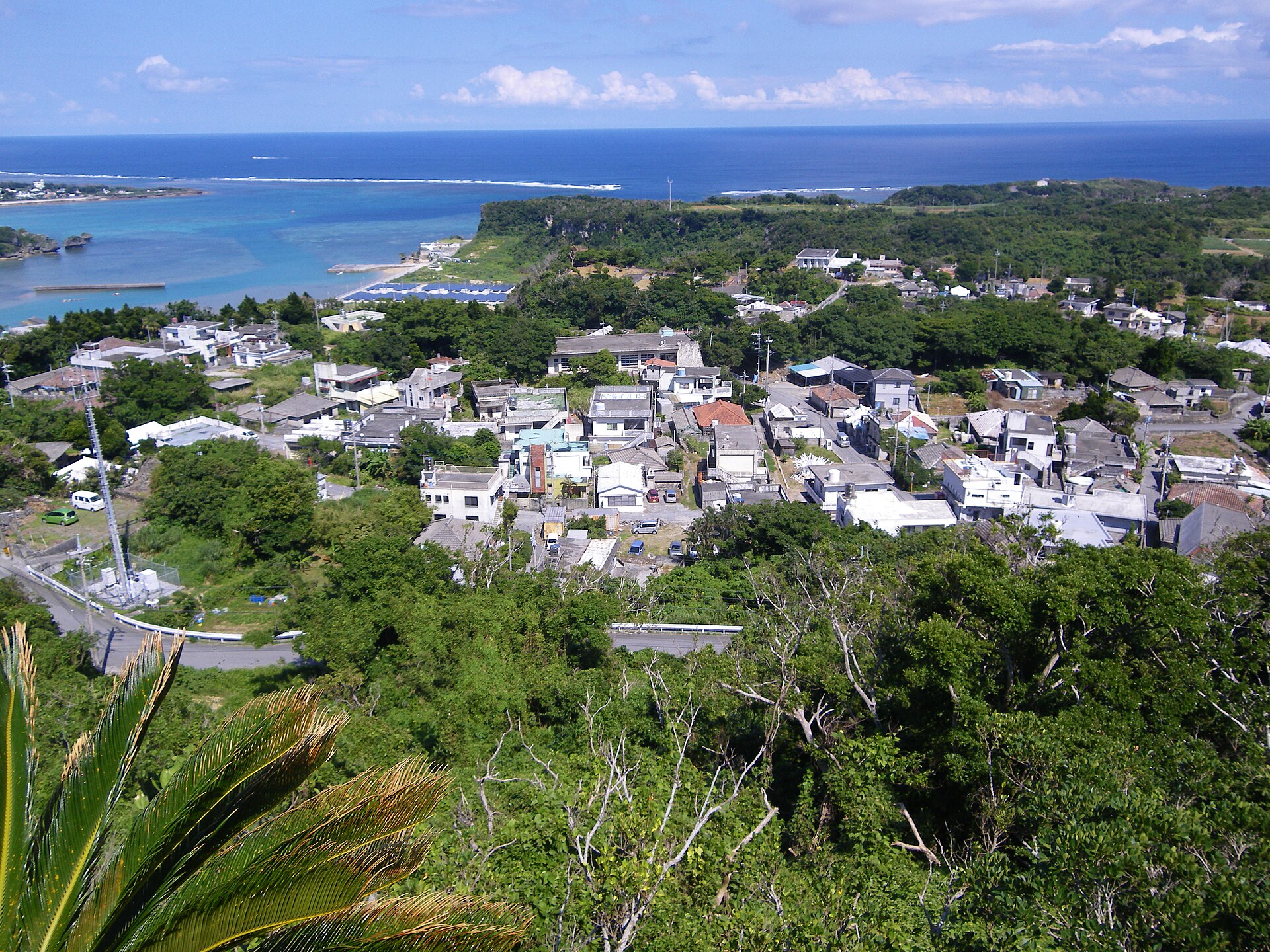
- Henza village on the spitclose-packed houses on the sandbar at the island's western end
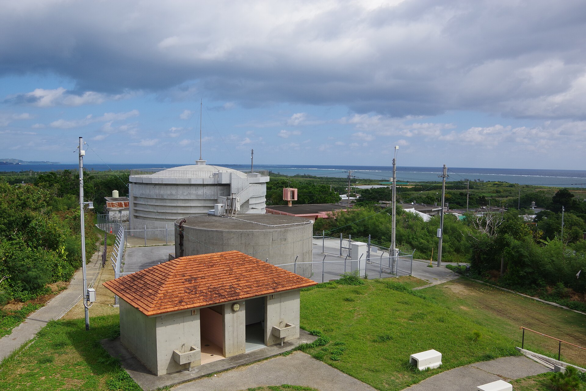
- Henza oil terminalrows of storage tanks on reclaimed ground, the reason the road exists
- Uehara and the Ii-baru tablelandfarmed plateau reaching about 120 metres, with the settlement below the escarpment
- Kafu Bantacliff-top lookout on Miyagi's north side, over a small beach and the reef below
How to actually get there
- From Naha, take an eastbound bus across the island to Yakena Bus Terminal on the Katsuren peninsula.
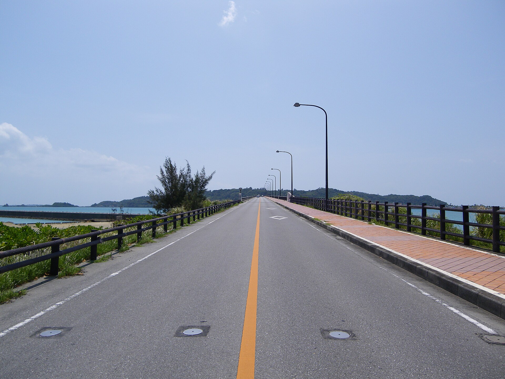
- Cross the causeway by car, taxi or island bus, stopping at the rest station halfway for the view in both directions.
- On Henza, loop the spit village and pass the tank farm, then carry on to Miyagi and climb to the tableland.
- Finish at Kafu Banta on the north side of Miyagi, then drive back the way you came while it is still light.
- Bus east to Yakena, then a vehicle
- From Naha, take a bus east across the island to Yakena Bus Terminal on the Katsuren peninsula. Yakena is the transfer point and the last place with a proper terminal. From there the causeway begins, and the way across is by rental car, taxi or the small island bus the city runs between Yakena and the bridged islands.
- Back from Yakena Bus Terminal
- Retrace the route as far as Yakena and pick up the westbound bus to Naha there. The island bus runs to a short daily timetable rather than a frequent one, so anyone without a car should fix the return connection before crossing. Drivers have no such constraint, but the causeway is unlit in places and better driven in daylight.
About the place
Henza and Miyagi lie off the Katsuren peninsula on the eastern side of Okinawa's main island, joined to it by a road laid straight across the shallows — about five kilometres of it, with open sea on either side. Henza takes the first landfall. Its houses crowd onto a sand spit at the western end, and behind them stands a field of white storage tanks visible long before you arrive. Miyagi, the larger island, rises into a tableland of cane and vegetable plots, with its settlements tucked below the escarpment. Reclaimed ground now fills the channel that once separated the two, so the drive from one to the other never feels like a crossing.
How to enjoy it
Mid-afternoon is the kindest light on the causeway, when the shallows on either side separate into bands of jade and blue. Stop at the rest station halfway in both directions — the view is a different one depending on the tide. Up on the tableland the lanes are quick to drive and easy to lose an hour on, and the lookout is best before the sun drops behind the plateau.
Background & history
An American oil company wanted the tank farm on Miyagi first. The island divided into camps over it, the opposition held enough of the land to stop it, and the terminal went to Henza instead. In return the company built the causeway, which opened in 1972 and later passed to the local authority and then to the prefecture as an ordinary public road. A bridge on to Ikei, the island beyond Miyagi, followed in 1982, so that a single continuous drive now reaches all three. What was laid down for oil became the everyday road for the islands at the end of it.
Before you go
- Cash
- The causeway and the bridges are ordinary public roads and carry no toll. Bring cash for the rest station, for the small shops in the villages and for bus fares, which are paid as you board.
- Good to know
- The road sits barely above the water and is completely exposed, so check conditions before crossing in typhoon season. The tableland is working farmland with narrow lanes used by tractors. The lookout stands at the top of a cliff with a long drop below it, so keep back from the edge in wind.
- Another way
- By car from the expressway, leave at Okinawa-Kita and take ordinary roads east across to the Katsuren peninsula, joining the causeway at its mainland end.
- After you get off
- Yakena Bus Terminal is on the main island, short of the causeway, and there is no sensible walking route from it to the islands. Cover the last stretch by island bus, taxi or car. Once you are on Miyagi, the settlements sit far enough apart that a vehicle still helps.
Nearby notes
 Opqr / CC BY-SA 3.0
Local life · Okinawa★
Ikei Island
2.9 km · straight line
 Kugel / CC BY 3.0
Culture · Okinawa★★
Hamahiga Island
5.1 km · straight line
 kanegen / CC BY 2.0
History · Okinawa★★★
Katsuren Castle Ruins
11.0 km · straight line
 Kugel~commonswiki / CC BY-SA 4.0
Local life · Okinawa★
Tsuken Island
13.5 km · straight line
Distances are straight lines on the map, not travel times.