Okukawachi · KawachinaganoNo.038★Open in map →
Takihata 48 Waterfalls
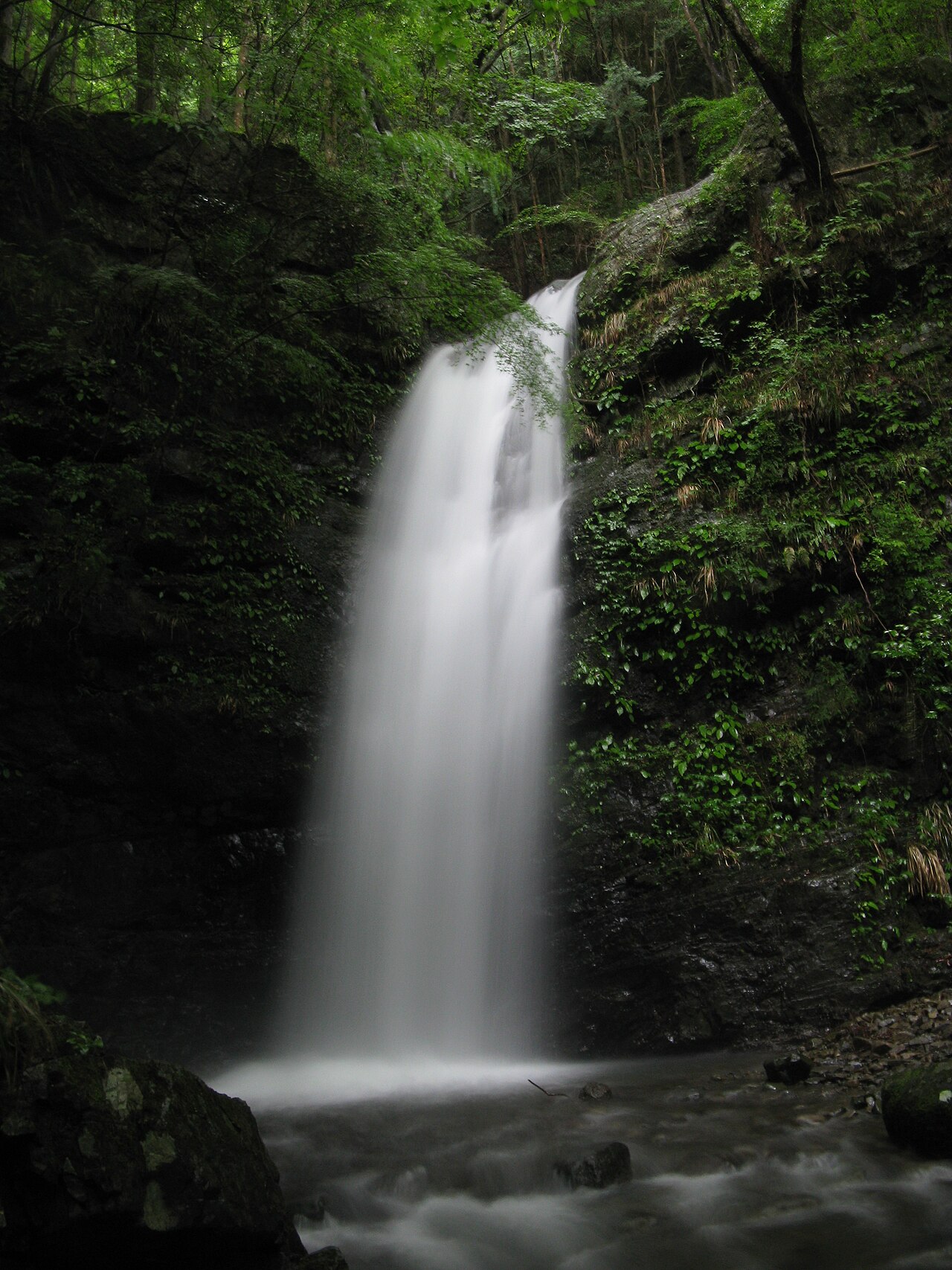
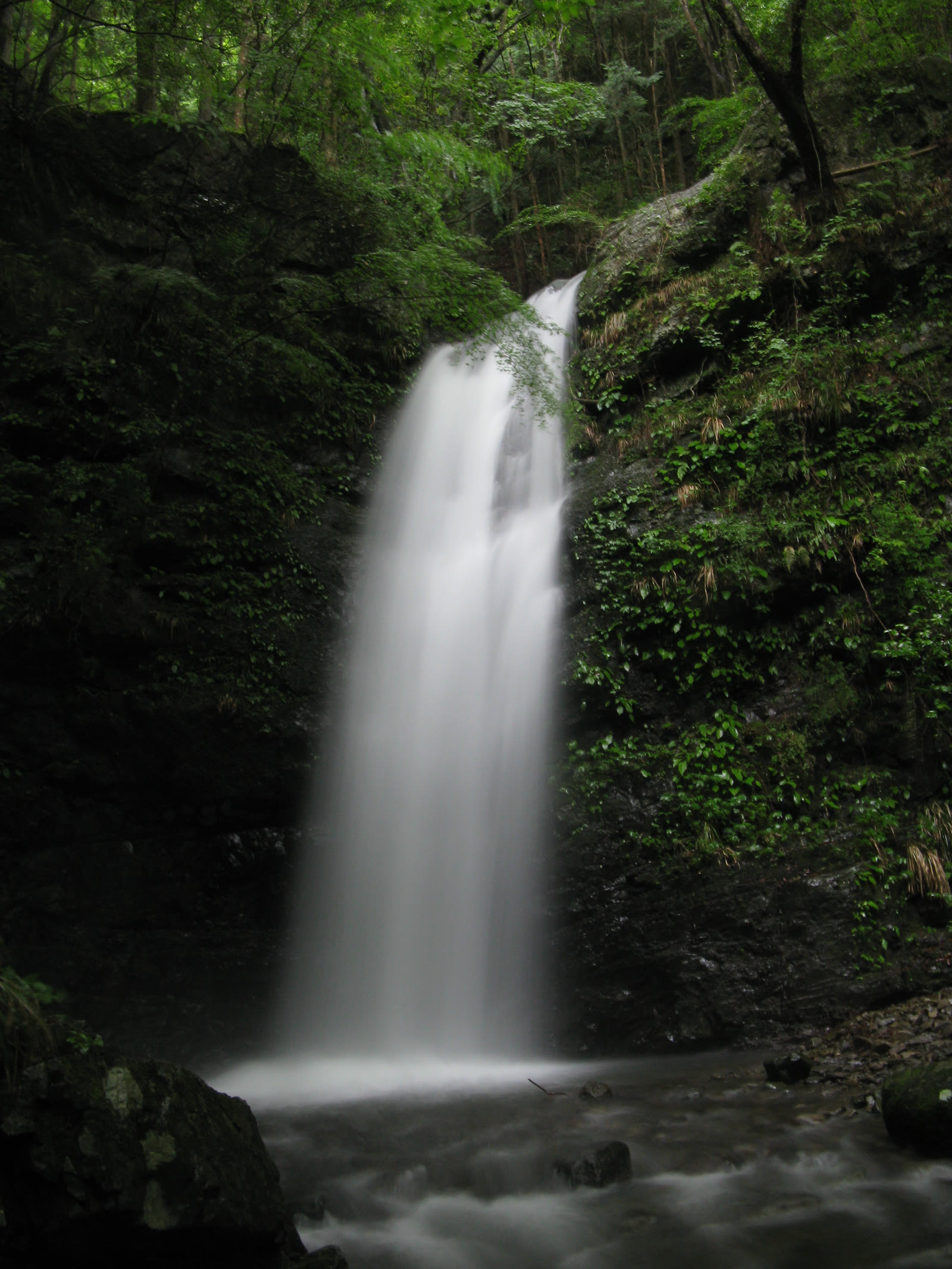
A string of waterfalls scattered through the upper Ishikawa River gorge in southern Osaka, collectively known as the 'forty-eight falls of Takihata.'
- FromNamba (Osaka)
- ~90 minbus (infrequent)
- Get off atTakihata Dam bus stop
- From there
- Takihata 48 Waterfalls
The sweet spot
It sits at the end of a valley with no train station and little English signage, reached only by an infrequent bus, so most visitors head to Koyasan or Minoo Falls instead and skip it.
Where it is
40 more notes in Osaka · open the map →What to look for — in walking order
- Takihata Dam and reservoirthe lakeside walking path at the valley mouth, where the bus route ends
- Kotaki, the largest fallthe main cascade and the source of the name of the nearby temple Kotakiji
- The named fallsOtaki, Gokotaki, Gongentaki and Arataki strung through the gorge
- Iwawaki-san trailheadone starting point for Mt. Iwawaki, a peak on the Diamond Trail ridge-walking route
How to actually get there
- Namba (Osaka) → Kawachinagano Station (Nankai Koya Line express, ~30 min)
- Kawachinagano Station → Takihata Dam stop (Nankai bus, Takamukai line, ~30-50 min)
- Takihata Dam stop → Kotaki falls (walk, ~25 min)
- Nankai train to Kawachinagano, then Nankai bus
- Namba (Osaka) →(Nankai Koya Line express, ~30 min)→ Kawachinagano Station →(Nankai bus, Takamukai line, to the last stop 'Takihata Dam', ~30-50 min)→ then a walk of roughly 25 min (about 2 km) to Kotaki falls. Total ~90 min. The bus runs only a few times a day — check the day's timetable before you leave.
- Return bus ends in the afternoon
- The bus from the dam back to Kawachinagano runs only a few times a day and the last one leaves in the late afternoon. When you arrive, check the return times posted at the stop and plan around them.
About the place
In the mountains of southern Kawachinagano, near the Wakayama border, water from the Izumi range drops through a steep, wooded gorge on the upper Ishikawa River, forming a succession of waterfalls along the valley. They are gathered under one name — Takihata Shijuhachi-taki, the forty-eight falls — though 'forty-eight' is an old figure of speech for 'many' rather than an exact count. The best known are Kotaki (the largest), Otaki, Gokotaki, Gongentaki and Arataki, threading through mossy rock under cedar trees. The falls and the Takihata Dam below them are together listed among 'Osaka's Hundred Green Spaces,' a prefectural list of notable natural sites.
How to enjoy it
From Kawachinagano Station, a Nankai bus climbs to the Takihata Dam stop, where the road ends and a riverside path leads up to the falls. A 300-yen cleaning-cooperation fee helps maintain the area. In summer the shaded, water-cooled gorge makes a fine half-day walk. The bus runs only a few times daily — check the return timetable at the stop when you arrive.
Background & history
The gorge lies inside Kongo-Ikoma-Kisen Quasi-National Park, which follows the Izumi range along the Osaka–Wakayama border. The Takihata name carries on in the nearby temple Kotakiji, whose name comes from the Kotaki waterfall; by the Edo period (1603–1868) the site was tied to the Katsuragi tradition of Shugendo, a form of Japanese mountain asceticism. Downstream, Takihata Dam — one of the largest multipurpose dams in Osaka Prefecture — forms the reservoir that marks the valley entrance.
Before you go
- Cash
- The bus fare is paid on board; rural Nankai buses are usually cash — carry coins and small notes just in case.
- Good to know
- This is a river path, not a tidy park — wear sturdy shoes and watch your footing on wet rock.
- Another way
- Coming by car is simpler: there is parking at the dam (paid), and you walk in from there.
- After you get off
- From the Takihata Dam bus stop, allow roughly 25 minutes on foot (about 2 km) along the road and riverside path to Kotaki, the largest of the falls.
Nearby notes
 Nankou Oronain (as36… / CC BY-SA 3.0
Nature · Osaka★
Ushitaki Gorge & Daiitoku-ji
6.1 km · straight line
 KENPEI / CC BY-SA 3.0
History · Wakayama★
Choishi-michi
8.8 km · straight line
 Morocco / CC BY-SA 4.0
History · Osaka★
Kanshin-ji
10.8 km · straight line
 KENPEI / CC BY-SA 3.0
Onsen · Osaka★
Inunakiyama Onsen
13.1 km · straight line
Distances are straight lines on the map, not travel times.